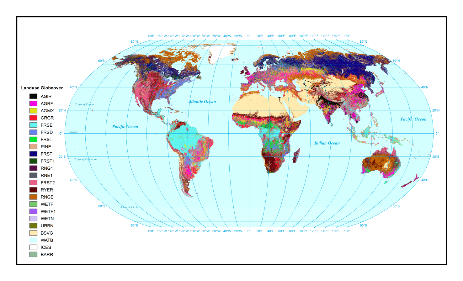
Global Landuse USGS
The Globcover global Land Cover map is a European Space Agency initiative to develop global composites and land cover maps using input observations from the 300m MERIS sensor onboard the ENVISAT satellite mission.
The Globcover covered December 2004 - June 2006 and was derived by an automatic and regionally tuned classification of a MERIS full resolution surface reflectance time series (Link).
The LandCover map contains 23 numerical classes corresponding to specific land cover types.
Associated files include: "Lookup_Landuse_Globcover.txt", and "SWAT2012.mdb".
Download related article from "Nature Scientific Data":
https://www.nature.com/articles/s41597-019-0282-4